A large parcel does not become a useful set of saleable plots simply by drawing boundary lines. You need to test title, access, zoning, drainage, infrastructure, approvals, and future construction before deciding whether subdivision will protect or reduce the land’s value.
Key takeaways
- Confirm title, survey boundaries, access rights, and zoning before designing plots.
- Reserve legal roads, drainage routes, utility corridors, open spaces, and amenity areas.
- Reject subdivision when narrow access, flooding, or irregular boundaries reduce buildable value.
- Use approved dimensions and circulation plans to protect each plot’s future usability.
What a complete plotting layout adds beyond dividing land
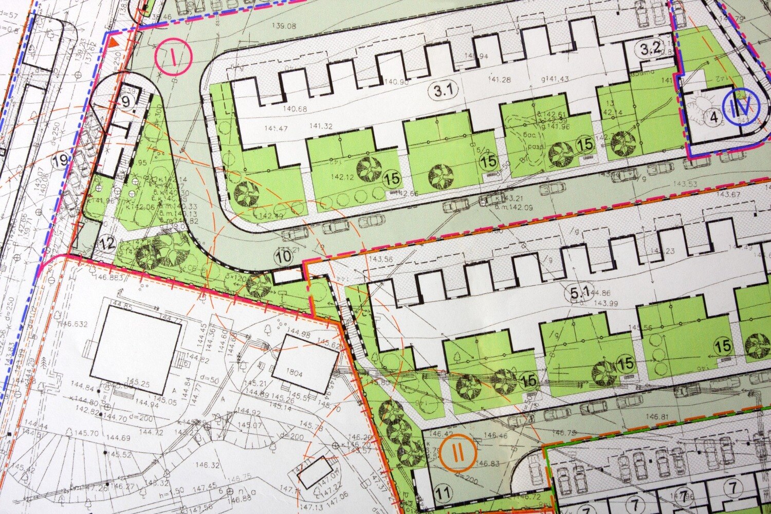
A complete layout turns one survey parcel into a buildable plan, not just a collection of smaller rectangles. It fixes plot boundaries alongside legally usable roads, entry points, drainage routes, utility corridors, open spaces, and amenity areas, so each buyer can reach and develop a plot without relying on an informal passage.
The plan must separate gross land area from net saleable area. Required roads, turning areas, reservations, drainage margins, recreational space, and utility land reduce the area available for private plots. Chasing the maximum plot count can leave narrow leftovers, poor access, and infrastructure costs that reduce the real value of every sale.
A subdivision plotting layout in Nagpur adds value by resolving practical questions before registration or construction:
- Can every plot connect to an approved access road?
- Where will stormwater flow during heavy rain without flooding lower plots?
- Where will electricity, water, sewerage, waste collection, and future pipe replacement run?
- Can emergency vehicles, delivery trucks, visitors, and people with disabilities move safely?
- Which land remains common, and who will maintain roads, drains, lights, and open areas?
This is how subdivision plotting layout for design helps property owners in Nagpur: it reduces easement disputes, demolition, service rerouting, and unusable strips. A modular office still needs parking, loading, fire access, utilities, and approvals beyond its building footprint.
Sanctioned subdivision establishes the development framework; it does not automatically approve each future house, shop, or office.
When subdivision is suitable—and when it weakens the property
Subdivision is practical when the parcel is large enough to create buildable plots after roads, drainage, open space, and utility corridors are deducted. Clear title, cooperative co-owners, lawful road frontage, and a defined residential or commercial use strengthen the case.
Your budget must cover surveying, design, approvals, road works, drainage, and service connections—not only boundary walls and sale advertising.
| Condition | Supports subdivision | Signals the wrong choice |
|---|---|---|
| Land shape and size | A reasonably regular parcel leaves space for compliant plots and internal roads. | An irregular or narrow parcel produces leftover strips, cramped plots, or excessive road area. |
| Ownership | One owner or documented consent among co-owners allows coordinated decisions. | Partition disputes, missing heirs, or unclear title can stop sales and approvals. |
| Access | An existing lawful approach road can serve every phase and emergency movement. | No compliant access, a disputed approach, or dependence on a future road weakens the plan. |
| Intended use | Plot dimensions and road widths match the proposed homes, shops, or offices. | Small plots cannot support setbacks, parking, loading, or drainage for the intended use. |
| Budget | Funds remain for infrastructure after professional and approval costs. | A low budget forces incomplete roads and utilities, reducing saleability. |
Land subdivision planning in Nagpur is a poor choice when a nala or low-lying area controls drainage, zoning restricts development, or the first phase depends on unapproved utilities. Compare the net saleable area with the infrastructure cost; retaining one larger, accessible property can preserve more value than creating several unusable plots.
The records and site facts to verify before drawing plots
Before relying on a proposed layout, match every line on the drawing with the ownership file and a licensed site survey. A drafting error cannot cure defective title, disputed access, or an encroachment.
Check these records before plotting layout design in nagpur:
- Obtain the registered title chain, latest 7/12 extract or property card, mutation entries, and an encumbrance certificate. Names, survey numbers, land area, tenure, and recorded mortgages must agree.
- Confirm legal access through the registered deed, sanctioned road record, or recorded right of way. Do not rely on an informal track used by neighbours.
- Commission a measurement survey showing boundary coordinates, pegs, existing fences, road widths, plot dimensions, levels, and corner cuts. Compare it with the documents.
- Mark wells, buildings, trees, overhead lines, drains, low points, adjoining walls, and encroachments. Record black-cotton soil, imported fill, slope, and monsoon runoff before fixing roads or foundations.
- Get written information on municipal water, sewerage, stormwater outlets, electricity lines, transformer locations, and connection points. A service shown nearby is not the same as capacity at your site.
| Check | Evidence to compare | If it differs |
|---|---|---|
| Title area | 7/12 or property card against survey | Recalculate the boundary and saleable area |
| Access | Registered right of way against site entry | Stop until lawful access is established |
| Levels and drainage | Survey levels against proposed roads | Redesign before water collects in plots |
| Utilities | Agency confirmation against layout corridors | Price extensions, pumping, or private systems properly |
How Nagpur approvals, zoning, and development rules shape the plan
A sanctioned layout does not authorise every future house, shop, office, or factory. Under the Maharashtra Regional and Town Planning Act, a material change of land use or development needs permission from the competent planning authority before work begins.
Confirm the parcel’s jurisdiction before commissioning land subdivision planning in Nagpur. Nearby land can follow different procedures, fees, portals, and development-control rules.
| Approval or check | Authority or source | What to confirm |
|---|---|---|
| Jurisdiction and layout sanction | Nagpur Municipal Corporation, Nagpur Metropolitan Region Development Authority, Nagpur Improvement Trust, or another notified local planning authority | The competent authority, submission route, fees, and current checklist |
| Land use and reservation | Sanctioned Development Plan, zoning map, and official land records | Residential, commercial, industrial, agricultural, no-development, road-widening, open-space, amenity, or public-purpose reservations |
| Layout compliance | Applicable development-control regulations | Minimum plot dimensions, prescribed road width and access, setbacks, open spaces, drainage, parking, utilities, and fire movement |
| Building permission | The relevant local building-permission authority | Separate approval for each house, shop, office, or modular workspace, including height, ground coverage, floor-space entitlement, sanitation, fire access, and utility connections |
Ask for the approved subdivision plotting layout in Nagpur, not only a sales drawing. Verify the title chain, 7/12 extract or property card, mutation entries, measurement survey, access evidence, and encumbrance information against the sanctioned plan.
Reserve space beyond building footprints for delivery vehicles, parking, accessible routes, transformers, waste handling, loading, and service replacement. A property layout architect in Nagpur can coordinate the survey, civil and drainage design, licensed professionals, utility agencies, and authority submission, but no designer can cure defective title or an affected reservation.
How good layout design protects value after approval
The safer layout is not the one with the most plots; it is the one that preserves usable value after roads, drainage, utilities, and common obligations are deducted. That is how subdivision plotting layout for design helps property owners in Nagpur: it converts gross land into a realistic, serviceable saleable area.
Compare each design team against the same evidence before appointing one:
| Factor | Compare | Warning sign |
|---|---|---|
| Net saleable area | Gross survey area minus roads, turning areas, open space, utility land, reservations, and drainage margins | Plot count calculated from gross area |
| Roads and access | Approved widths, turning space, corner cuts, and connection to the public road | Narrow lanes or informal access shown only on site |
| Drainage | Finished levels, roadside drains, culverts, outfall, and downstream capacity | Low land filled without a drainage study |
| Utilities | Water, power, sewer or septic routes, meter access, and service corridors | Services cross private plots without easements |
| Phasing | Which roads and services are delivered before each plot is sold | Early sales depend on infrastructure promised later |
| Maintenance | Responsibility for drains, roads, lighting, open spaces, and common utilities | No written handover or maintenance arrangement |
Ask for a marked-up survey, area statement, drainage concept, utility plan, phase schedule, and responsibility matrix. Then compare the approved drawing with boundary pegs, registered documents, and actual road widths.
A property layout architect in Nagpur should coordinate the licensed architect or permitted professional, surveyor, civil designer, utility agencies, and authority submission. Whether you appoint Arch'N' Angles Architect's or another team, test that coordination in writing before work begins.
Related product
Residential & Commercial Sector Subdivision Plotting Of Layout Subdivision Plotting Of Layout |
Frequently asked questions
What does a complete plotting layout add beyond dividing land?
It establishes plot boundaries together with legally usable roads, entry points, drainage routes, utility corridors, open spaces, and amenity areas.
When is subdivision suitable for a Nagpur property?
Subdivision suits land with clear title, verified survey boundaries, workable access, suitable zoning, and enough area for roads and shared infrastructure.
Which records and site facts should owners verify first?
Check the title documents, survey and measurement records, access rights, zoning, existing structures, levels, drainage conditions, utilities, and physical site boundaries.
How do approvals and development rules shape a plotting layout in Nagpur?
Zoning, road requirements, open-space provisions, access standards, and local approval conditions determine the plots, circulation, infrastructure, and reserved areas shown in the plan.
Keywords